Smarter Farming with Multispectral AgHawk Dynamics Drones
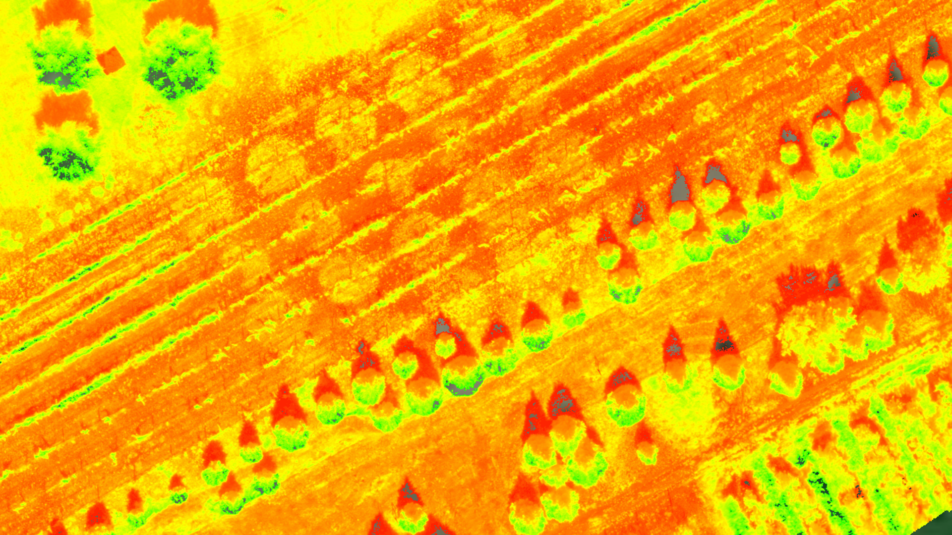
Multispectral drone imaging measures how crops reflect light across multiple wavelengths — including near-infrared invisible to the human eye — to detect disease, nutrient deficiency, pest damage, and poor germination before any problem is visible from the ground. AgHawk Dynamics uses this data to generate prescription maps that direct reseeding, spraying, and fertilizer application only where fields actually need it.
What is multispectral imaging and how is it different from regular drone photos?
Regular cameras capture the visible light spectrum — red, green, and blue. Multispectral cameras add near-infrared (NIR) and red-edge bands that healthy plants reflect strongly and stressed plants do not. This makes invisible crop stress visible as color-coded maps across entire fields, often weeks before symptoms appear to the naked eye.
The most commonly used index is NDVI (Normalized Difference Vegetation Index), which compares NIR and red light reflectance to produce a vitality score for every section of the field. Lower NDVI readings indicate stressed plants — but identifying why requires ground-truthing and agronomic interpretation.
Which parts of my field need reseeding — and how do I find them?
Multispectral drones identify poor germination zones — areas where plant establishment is thin, patchy, or absent — by measuring the difference in NIR reflectance between well-established and bare-soil zones. This produces a map showing exactly which parts of the field have gaps that warrant reseeding.
Without aerial data, identifying poor establishment requires extensive walking or random sampling that misses variability across large fields. AgHawk generates precision reseeding prescriptions from flight data that load directly into variable-rate equipment, reducing wasted seed and targeting problem zones with the right seeding rate.
Can I spray herbicide only where weeds actually are?
Yes. Multispectral mapping identifies weed pressure zones by detecting spectral signatures that differ from the target crop. AgHawk generates custom prescription maps that direct herbicide application only to areas where weed density warrants treatment — rather than treating the entire field at a flat rate.
Targeted weed control reduces herbicide volume applied per season, lowers chemical cost, and decreases selection pressure for resistance. For fields with variable weed pressure — heavy along edges, light in centres — variable-rate application can cut herbicide use significantly without sacrificing control.
How early can multispectral imaging catch crop problems?
Multispectral sensors can detect physiological stress in plants several days to weeks before visible symptoms appear, because cellular damage — slowed photosynthesis, impaired chlorophyll function, disrupted water movement — creates measurable changes in light reflectance before leaves yellow or wilt.
AgHawk drone analytics identify disease hotspots, nutrient deficiencies, pest infestations, and water stress zones early in their development. This early detection window is the difference between a targeted fungicide application to an isolated zone and a field-wide emergency spray.
How do I know if my spray application actually worked?
Post-application multispectral flights compare plant health indicators before and after treatment, measuring whether treated zones show recovery in NIR reflectance and stress reduction over time. This closes the feedback loop on every input decision and identifies areas that need follow-up attention.
For fungicide and fertilizer applications, the difference between treated and untreated response is measurable in 10 to 21 days depending on the product and crop. Follow-up prescription maps can direct second applications only to zones where the first application underperformed.
Frequently Asked Questions
What is multispectral imaging and how is it different from regular drone photos?
Regular cameras capture visible light (red, green, blue). Multispectral cameras add near-infrared and red-edge bands that healthy plants reflect strongly and stressed plants do not. This makes invisible crop stress visible as color-coded maps, weeks before symptoms appear to the naked eye.
What problems can multispectral drones detect?
Fungal disease, bacterial infection, nutrient deficiency (especially nitrogen and iron), water stress, poor germination, weed pressure, and pest damage all show as reduced NIR reflectance or abnormal spectral signatures that multispectral analysis can flag.
What is a prescription map and how do I use it?
A prescription map is a georeferenced field map that assigns different input rates to different zones based on what the drone data shows. It loads directly into variable-rate tractor equipment or guides targeted drone application, so product only goes where it is needed.
How many acres can AgHawk map in a single session?
Coverage depends on flight altitude and resolution requirements, but multispectral mapping can typically cover several hundred acres per day. Higher resolution for individual plant analysis covers less area; lower resolution for field-scale stress mapping covers more.
Do I need to do anything before or after a drone mapping flight?
Before: have your fields accessible and note any areas of particular concern. After: review the output maps with your agronomist or the AgHawk team to confirm diagnoses and build prescriptions. Ground-truthing suspicious zones improves the accuracy of the action plan.