AERIAL AGRICULTURAL SERVICES
Unlock the Power of Data-Driven Farming
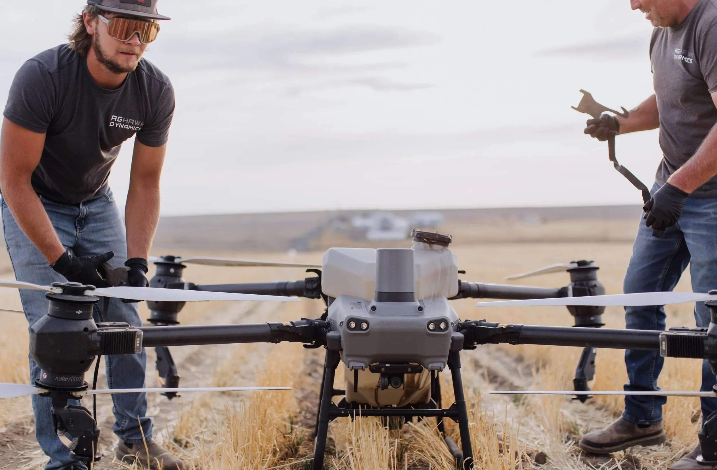
From spraying and seeding to crop health monitoring, our drones help growers manage fields, orchards and vines more effectively, efficiently, and reduce unnecessary waste.
Spraying
High-precision aerial spraying for foliar nutrients, crop protection chemicals, herbicides, fungicides and pesticides. Our drones provide even coverage across fields, orchards and vines, reduce chemical waste, and limit soil compaction compared to traditional equipment. Real-time monitoring ensures targeted application, reducing environmental impact while improving crop health. Ideal for orchards, row crops, vineyards, and other large-scale operations.
Irrigation Monitoring
Identify water stress, dry zones, and over-irrigated areas quickly with aerial imaging. Our drones enable precision irrigation planning, conserving water resources while maintaining crop health. Early detection of irrigation issues reduces yield loss and helps optimize resource use.
Spreading
Aerial spreading of seed, fertilizer, or cover crops allows for uniform distribution across difficult terrain, sloped fields, or areas inaccessible to ground equipment. Our drones improve efficiency, reduce labor costs, and minimize crop disruption. Perfect for establishing cover crops, enhancing soil fertility, or reseeding problem areas.
Weed & Pest Detection
Using high-resolution imaging, our drones detect early signs of weeds, pests, or disease before they spread. This allows for timely intervention, reducing crop loss and lowering input costs. Advanced analytics provide actionable maps and reports, helping farmers make precise treatment decisions.
Field Mapping
Comprehensive mapping of acreage, crop health, and topography using aerial imagery. Maps can support planting strategies, fertilization planning, and yield optimization. Includes slope and elevation analysis to improve soil and water management.
Plant Performance & Reseed Prescriptions
Evaluate crop stands, identify underperforming areas, and generate reseeding plans. Our analytics help optimize inputs and maximize yield by targeting the exact areas that need attention, saving time, materials, and money.
Crop Damage Assessment
Document storm, hail, pest, or wildlife damage with detailed aerial imagery. These reports can support insurance claims, disaster recovery, and farm planning. Quick deployment ensures accurate assessment while minimizing on-ground labor.
Fruit Drying
Targeted airflow application using drones to accelerate drying of fruits after rain or irrigation, reducing post-harvest loss. This precision approach minimizes manual labor while maintaining crop quality.
Aerial Imaging
Capture high-resolution images and videos for scouting, monitoring crop performance, marketing, and record-keeping. High resolution imaging provides insights beyond the visible spectrum, supporting data-driven decision-making.
Livestock Monitoring
Monitor herd health, location, and behavior. Drones can cover large or difficult terrain, reducing time spent on inspections and improving animal management. Ideal for ranchers, dairy farms, and large pasture operations.